In 1729, the Paxton Township of Lancaster County was established. It was comprised of what is now Lower, Middle, and Upper Paxton Townships, as well as Susquehanna Township. The word “Paxton” was actually brought over by the Scottish settlers and means “town (or area) of Peace”.
On March 4, 1785, the County of Dauphin was formed from Lancaster County. The word “Dauphin” (French for “dolphin”) was the name / title given by the King of France to his eldest son, the heir apparent to the throne. The area government wished to honor France for its assistance in the Revolutionary War.
Two years later in August of 1787, Middle Paxton Township was sectioned off from the original Paxton Township.
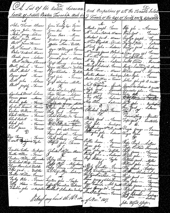
The image below is a Tax List for Middle Paxton Township from the year 1807 (courtesy of the PA Historical & Museum Commission). A clearer, easier to read version of this image can be found online here.
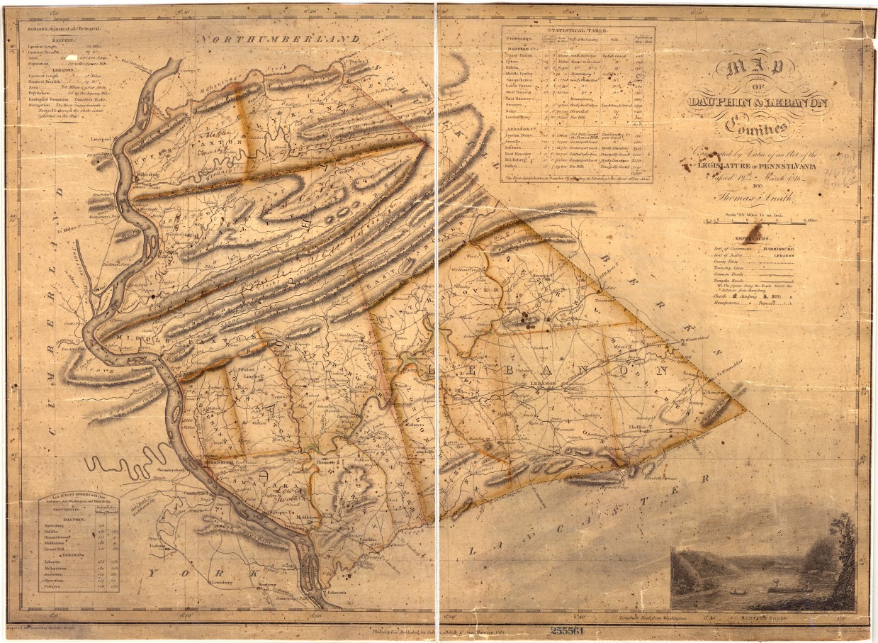
The image below is the Melish-Whiteside map for Dauphin and Lebanon Counties, created in 1818.
“Based upon actual county surveys, the Melish-Whiteside maps were the first official set of county maps produced for the Commonwealth of Pennsylvania. Township lines, municipality names, and roads and distances are examples of the details present on each survey. In addition, structures such as post offices, factories, mills, mines, furnaces, forges, houses, churches, academies, and taverns are noted, as are the names of property owners for certain taverns, dwellings, furnaces, and mills.
The maps were the result of the work of John Melish, a geographer, traveler, and entrepeneur who convinced the Pennsylvania legislature to fund this ambitious cartographic project. Under enabling legislation passed on March 19, 1816, a number of deputy surveyors spread out across the Commonwealth. Over the ensuing years, these surveyors would produce maps for each county, which could then be assembled into a full and accurate map of the state. The deputy surveyors handed over their completed maps to the surveyor general, who in turn sent the maps to Melish for copying and engraving. But before these maps were delivered, a clerk made an office copy of the original. The first clerk to execute these copies was named John Whiteside, and since his signature appears on these versions, they have become known as the “Whiteside Maps” (several copies were also rendered by a Dan Small). Melish submitted his completed Pennsylvania map to the legislature in March 1822, which overwhelmingly approved his work, claiming the map was “an exquisite specimen of graphic skill,” and well worth the $29,276.75 spent on the project.”
Image and description courtesy of the PA Historical & Museum Commission. A clearer, easier to read version of this image can be viewed online here.